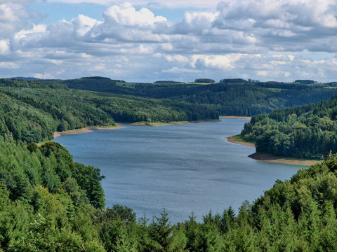
10 dams on one vacation route - discover the region with the most dams in Europe by motorhome, car or motorcycle.
Talsperren-Route
Short facts
- start: Parkplatz Krombacher Insel, Elbachtal, 51580 Reichshof-Nespen
- destination: Wanderparkplatz Lindscheid, Wermelskirchen
- very easy
- 153,28 km
- 2 hours 33 minutes
- 2101 m
- 457 m
- 101 m
best season
Weather
Good to know
- Nature Highlight
- Stop at an Inn
- Possibility of Accommodation
Parkplatz Krombacher Insel, Elbachtal, 51580 Reichshof-Nespen
Wanderparkplatz Lindscheid, Wermelskirchen
Nespen - L324 Odenspiel - Erdingen - L344 Denklingen - B256 - L336 Brüchermühle - K16 Schemmerhausen - L148 - L96 Hasbach - L324 Eckenhagen - K50 Hahnbuche - K23 Bergneustadt - Hackenberg - L337 Lantenbach - L323 - L337 Unnenberg - Dannenberg - Müllenbach - L306 - Müllenbacher Straße - B256 - Brucher Straße - Neuenhaus - Klosterstraße - L97 Höfel - Oberwipper - B256 Ohl - B237 Rönsahl - K2 - Mittel-Heukelbach - Rönsahl - Großfastenrath - Auf dem Heede - L284 Wasserfuhr - K30 Kreuzberg - Schevelinger Weg - L284 Wipperfürth - B237 - K13 - Neye - Beverstraße - Hartkopsbever - K5 Oberlangenberg - Großhöhfeld - Müllensiepen - K11 Heinhausen - B483 Radevormwald - B229 - L412 Heide - Kräwinkel - Dörpholz - Lüdorf - K2 Hückeswagen - K1 - B237 - L68 Winterhagen - L101 Dreibäumen - Habenichts - L409 Dhünn - Hülsen - Halzenberg - Leudenberg - B506 Weiden - Unterossenbach - Richerzhagener Straße - Mühlenstraße - L310 Neschen - Altenberg - L101 Dabringhausen - Altenberger Straße - K11 Käfringhausen - K16 Ketzbergerhöhe - Engerfeld - Lindscheid (Wanderparkplatz)
Der offizielle Startpunkt der Talsperren-Route (und des gpx-Tracks) befindet sich am Parkplatz Krombacher Insel in Reichshof-Nespen. Der Einstieg in die Tour ist aber natürlich überall möglich. Wir empfehlen aber folgende Einstiegspunkte, falls Sie über die Autobahn anreisen:
- A1-Ausfahrt 97 (Burscheid)
- A4-Ausfahrt 27 (Eckenhagen)


